Airborne Lidar Shows Western Snowpack at 18% of Avg

Get the Energy newsletter
Daily energy & climate — solar, EVs, oil, the policy fights and tech bets shaping the transition. Free.
- Airborne Snow Observatories used Lidar with about 800,000 pulses per second, achieving 3 cm accuracy in snow‑depth mapping.
- Tom Painter said this year’s snowpack loss is “unprecedented” and “not in the record at all,” highlighting a distinct dry year.
- U.S. Drought Monitor reports that over 60 % of the lower 48 states are experiencing drought, the widest spring dry spell since 2000.
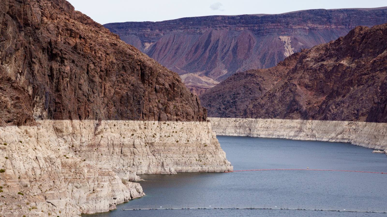
- California’s statewide snowpack was measured at just 18 % of average on 1 April, its lowest level on record for that date.
- Tom Albright noted that spring runoff from snowmelt in Nevada is two months ahead of schedule, raising fire risk and threatening Colorado River reservoirs.
- Nevada’s early melt means the landscape dries months ahead of schedule, extending the dry season and increasing wildfire danger.
Why it matters: Water managers in the West lose a reliable seasonal reservoir as the snowpack shrinks to 18 % of average, forcing early runoff that fuels wildfires and leaves Colorado River reservoirs critically low, while farmers and urban users face tighter water supplies.